
Drones technology continues to fundamentally reshape how commercial businesses operate across the United States today, offering unprecedented levels of operational efficiency. What originally started as specialized military hardware has transformed into a massive commercial industry over the past decade. Today, unmanned aerial vehicles provide critical data collection capabilities for countless companies operating nationwide. These sophisticated platforms allow for the rapid acquisition of high-resolution spatial data that was previously inaccessible or prohibitively expensive to obtain via traditional methods.
We will examine the economic impact, hardware advancements, and software integrations driving this sector forward in the global marketplace. Many enterprise organizations rely on these sophisticated aerial platforms to maintain a competitive advantage in their respective markets. You can expect to see even more industries adopting aerial data collection methods in the near future as the technology becomes more accessible. The transition from manual inspections to automated workflows represents a significant milestone in the digital transformation of the modern American workforce.
Drones technology delivers a highly measurable return on investment for major American industries right now. Companies use aerial platforms to gather high-resolution imagery and topographical data incredibly efficiently. This modern approach drastically reduces the time required for traditional ground-based surveying methods while improving overall data accuracy. By deploying commercial drones, businesses can capture thousands of data points in a single flight, providing a comprehensive overview of their physical assets.
The integration of specialized sensors allows these aircraft to perform tasks that were once considered dangerous or impossible for human workers. Whether it is inspecting high-voltage power lines or monitoring active volcanic activity, UAVs provide a safe buffer between personnel and hazardous environments. Furthermore, the cost-effectiveness of these systems allows smaller enterprises to compete with larger corporations by accessing high-tier analytical tools at a fraction of the historical cost.
Precision Agriculture and Multispectral Drones Technology for Crop Monitoring
Farmers utilize advanced multispectral sensors to monitor crop health across thousands of acres of farmland. These detailed aerial assessments help agricultural operations reduce water usage and optimize their fertilizer application. According to the United States Department of Agriculture, precision agriculture increases overall crop yields significantly. By identifying specific areas of stress, farmers can address issues before they impact the entire harvest.
Agronomists analyze the vegetation index data to spot early signs of disease or pest infestation. Catching these agricultural problems early saves commercial farms thousands of dollars in lost revenue annually. Farmers can apply treatments exactly where needed instead of spraying entire fields indiscriminately, which also benefits the local ecosystem. Additionally, thermal imaging sensors can detect irrigation leaks or drainage issues that are invisible to the naked eye from the ground.
The use of LiDAR sensors in agriculture is also expanding, allowing for the creation of highly accurate digital elevation models. These models help in planning drainage systems and managing soil erosion more effectively over long periods. As climate patterns become more unpredictable, the ability to monitor field conditions in real-time becomes a critical component of modern food security strategies.
Infrastructure Monitoring and Drone Surveying in Construction and Engineering
Construction managers deploy commercial quadcopters to track site progress and calculate massive stockpile volumes safely. Sophisticated photogrammetry software converts flat drone photos into highly accurate 3D models of active work sites. This spatial data helps project stakeholders catch costly errors before they require expensive physical rework. By maintaining a digital twin of the construction site, managers can compare “as-built” conditions against original architectural designs.
Many structural engineering firms process this aerial data weekly to keep distant investors updated on building progress. construction drone surveying software allows for the seamless integration of drone data into existing BIM (Building Information Modeling) workflows. Using drones prevents workers from having to climb dangerous scaffolding to inspect hard-to-reach areas, significantly reducing workplace accidents. The combination of improved worker safety and faster data collection makes drones indispensable for modern construction projects.
Beyond simple photography, drone mapping provides centimeter-level accuracy when paired with ground control points or RTK (Real-Time Kinematic) technology. This level of precision is essential for land development, road construction, and large-scale infrastructure projects. Engineers can now perform volumetric analysis on earthwork in minutes, a task that previously took surveying crews several days to complete manually.
Key Takeaways
- Aerial surveying reduces the time and cost associated with traditional ground-based data collection methods.
- Multispectral sensors allow farmers to identify crop diseases early and optimize their fertilizer usage.
- Photogrammetry software converts basic drone photos into highly accurate 3D models for construction managers.
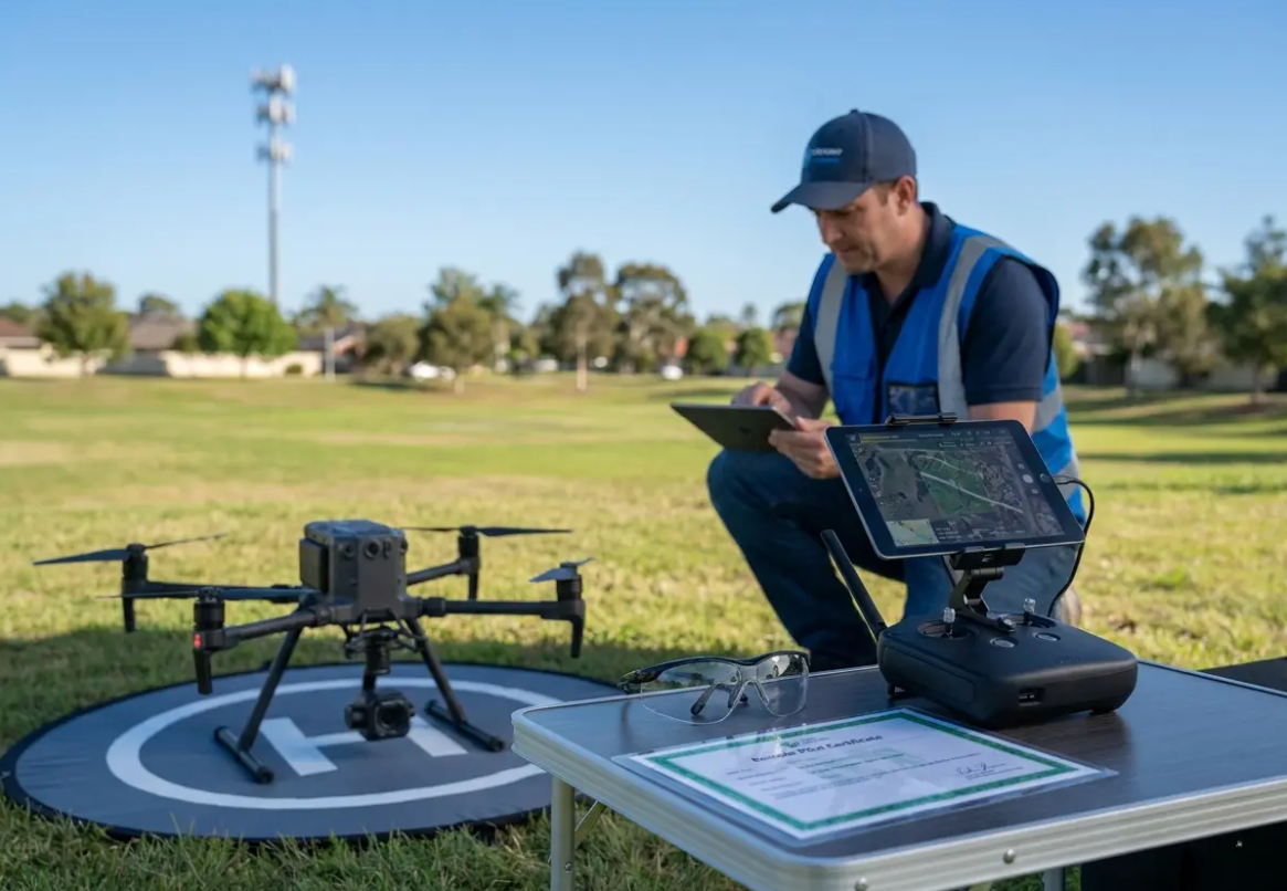
FAA Compliance and Regulatory Frameworks for US Airspace: Navigating Part 107
Operating drones commercially requires strict adherence to Federal Aviation Administration guidelines at all times. The FAA established the Part 107 rule to integrate unmanned aircraft into national airspace safely and predictably. Commercial pilots must pass a comprehensive aeronautical knowledge test to obtain their remote pilot certificate, which must be renewed every two years. This regulatory framework ensures that all operators possess a fundamental understanding of aviation safety and operational limitations.
This certification process proves that operators understand weather patterns, airspace classifications, and critical emergency procedures. You cannot legally charge money for your drone services without holding an active Part 107 license. Failing to maintain your certification can result in severe financial penalties for your business and may void your professional liability insurance. It is also important to note that specific operations, such as flying over people or at night, may require additional waivers or specific equipment compliance.
Pro Tip
Always check local temporary flight restrictions (TFRs) before launching your aircraft into the sky. The FAA regularly updates these airspace rules around sporting events, wildfires, and presidential movements to ensure public safety.
Remote identification (Remote ID) regulations now require most commercial drones to broadcast their exact location data continuously. This digital license plate system helps law enforcement monitor aerial traffic near sensitive public facilities and ensures accountability for all operators. Strict compliance prevents hefty fines and protects your company from serious operational liability issues that could arise from unauthorized flights. As the airspace becomes more crowded, these tracking systems are vital for maintaining a safe environment for both manned and unmanned aircraft.
You should establish a robust compliance tracking system to monitor pilot certifications and aircraft registrations. drone fleet management tools can automate much of this administrative burden by tracking flight hours and maintenance schedules. Maintaining detailed flight logs protects your organization if an accident occurs during a commercial operation by providing a clear record of pilot actions. Proper documentation proves to federal investigators that your pilots followed all required safety protocols and pre-flight checklists.
Strategic Implementation: How to Launch a Commercial Drone Program and Fleet
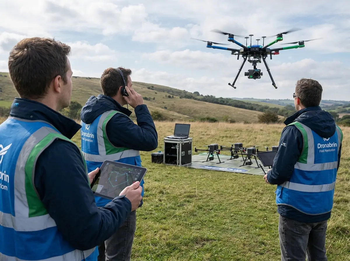
Starting a successful drone program requires careful planning and strategic equipment selection from the very beginning. Many organizations fail because they purchase expensive hardware without defining their exact data requirements first. How can your business successfully implement this technology without wasting valuable capital? The key lies in understanding the specific deliverables needed to drive decision-making within your organization.
A methodical approach prevents wasted capital on aircraft that cannot perform your required commercial tasks. You must understand exactly what type of deliverables your internal stakeholders expect from the flight team, whether it is raw video or processed 3D maps. Establishing clear goals makes the hardware selection process much easier and more cost-effective, ensuring that your investment yields the highest possible utility. Furthermore, choosing the right software platform for data processing is just as important as the aircraft itself.
Steps to Build Your Aerial Operations
Define Your Mission Parameters
Determine exactly what data you need to collect before purchasing any hardware for your organization. Consider factors like flight duration and sensor requirements.
Tip: Create a checklist to verify you don’t miss any critical operational prerequisites or safety requirements.
Select the Right Hardware and Payload
Choose between fixed-wing systems for large agricultural areas or multi-rotor drones for precise infrastructure inspections. Ensure the payload capacity matches your sensor needs.
Tip: Balance your initial hardware budget with the long-term maintenance costs and battery replacement cycles of the aircraft.
Establish Standard Operating Procedures
Create detailed workflows for pre-flight inspections, battery management, and post-flight data processing tasks to ensure consistency and safety.
Following these exact steps helps organizations scale their aerial operations without compromising safety or data quality. Your pilots need clear guidelines on how to handle equipment malfunctions and sudden weather changes during a mission. Regular training sessions keep flight crews sharp and ready for complex commercial deployments in challenging environments. As your program grows, you may also need to consider specialized insurance policies designed specifically for commercial drone operations.
Cybersecurity Protocols: Data Security and Privacy Concerns in Aerial Operations
Securing the data captured by commercial drones represents a massive concern for modern enterprise organizations. Unmanned aerial vehicles routinely photograph sensitive infrastructure, proprietary manufacturing facilities, and private agricultural land. Are you adequately protecting the sensitive information gathered during your commercial flights from potential cyber threats? The risk of data interception or unauthorized access is a reality that every drone program manager must address.
Protecting this vital information from unauthorized access requires robust encryption protocols on the aircraft and the ground station. You must treat your drone data with the same rigorous security standards applied to your corporate IT networks and cloud storage. Many hardware manufacturers now offer enterprise-grade encryption for their radio transmission signals during flight to prevent “man-in-the-middle” attacks. Additionally, organizations should implement strict data sovereignty policies to ensure that sensitive information is stored on secure, domestic servers.
This critical feature prevents bad actors from intercepting the live video feed during a sensitive commercial operation. Furthermore, companies must implement strict access controls for the cloud platforms storing the final processed models and raw imagery. secure drone data storage solutions provide the necessary infrastructure to manage large volumes of spatial data while maintaining strict compliance with privacy laws. Taking data security seriously builds trust with your clients and protects your company from embarrassing breaches that could damage your professional reputation.
Autonomous Flight and AI Integration in UAVs and Intelligent Systems
Artificial intelligence completely changes how drones process information during complex commercial flight operations today. Modern drones technology uses advanced machine learning algorithms to detect and avoid physical obstacles automatically, even in GPS-denied environments. This impressive capability allows pilots to focus on high-level data collection rather than basic flight maneuvers, increasing overall mission efficiency. AI-driven flight planning also ensures that the aircraft follows the most efficient path to conserve battery life.
Advanced collision avoidance systems use multiple optical sensors and ultrasonic transducers to build a real-time map of the environment. Computer vision models can identify structural defects on bridges or wind turbines in real time as the drone flies past. The intelligent software highlights potential rust, cracks, or missing bolts without any human intervention, providing immediate feedback to the inspection team. This real-time analysis allows for “on-the-fly” decision making, where a pilot can choose to investigate a detected anomaly more closely.
Researchers at prestigious institutions like MIT continue developing lighter algorithms that run directly on the drone itself, known as edge computing. This on-board processing capability drastically reduces the time needed to analyze structural data after the flight by filtering out irrelevant footage. Automated analysis saves engineering teams hundreds of hours reviewing video footage manually back at the office, allowing them to focus on remediation strategies instead. As AI continues to evolve, we can expect drones to perform even more complex tasks, such as autonomous repair or contact-based inspections.
Key Takeaways
- Artificial intelligence enables drones to navigate complex environments and avoid physical obstacles automatically.
- Computer vision models detect structural defects on critical infrastructure without requiring manual human review.
- On-board processing capabilities drastically reduce the time needed to analyze aerial data after landing.
BVLOS and the Future Outlook for Aerial Systems and Drone Delivery
The next decade of drones technology points directly at beyond visual line of sight (BVLOS) operations. Currently, most commercial flights require the pilot to maintain direct visual contact with the aircraft, which limits the operational range. Widespread adoption of BVLOS flights will enable long-distance delivery networks and automated infrastructure inspections across vast geographic areas. This shift will require more advanced communication links, such as 5G connectivity, to ensure low-latency control over long distances.
Several major logistics companies are already testing medical delivery routes in rural parts of the United States to transport life-saving supplies quickly. Urban air mobility (UAM) represents another massive shift in the broader commercial aviation sector entirely, promising to revolutionize how we move through cities. Heavy-lift drones will eventually transport cargo and passengers across highly congested metropolitan areas safely, bypassing ground-level traffic. The integration of “drone swarms” could also allow for massive data collection missions where multiple aircraft work in coordination.
Numerous American companies are currently testing electric vertical takeoff and landing (eVTOL) vehicles for public use. The blank” rel=”noopener”>FAA’s Advanced Air Mobility initiative aims to integrate these larger vehicles into existing flight corridors safely. These futuristic transportation systems will likely become a normal part of urban life within the next twenty years, fundamentally changing our relationship with the sky. As battery technology improves, we will see longer flight times and increased payload capacities, further expanding the possibilities of aerial systems.
Conclusion
Drones technology offers undeniable financial advantages for forward-thinking organizations across the country today. The integration of advanced sensors and artificial intelligence creates powerful new workflows for traditional industries like construction and agriculture. Companies that adopt these sophisticated aerial systems gain a distinct competitive edge in their respective commercial markets by leveraging data-driven insights. The ability to see your operations from a new perspective is no longer a luxury, but a necessity for modern business management.
You can collect better structural data faster and safer than ever before with modern unmanned aircraft and specialized software. As federal regulations adapt to new hardware capabilities, commercial drone operations will continue expanding rapidly into new sectors. Will your organization adapt to these changes or fall behind more agile competitors who have already embraced the aerial revolution? The window for early adoption is closing, and the time to integrate these tools is now.
You should evaluate how aerial data collection can improve your current business processes right now to maximize efficiency. The initial financial investment in pilot training and equipment pays dividends through increased safety and operational efficiency over the long term. Embracing drone operations today prepares your business for the automated workflows of tomorrow, ensuring you remain relevant in an increasingly digital world. This strategic integration of UAV technology ensures that your organization remains at the forefront of innovation within the modern industrial landscape.
